
Trade and Archaeology on the Grand Trunk Road - An Introduction
- Afifa Khan
- Nov 2, 2020
- 11 min read
Updated: Nov 11, 2020
"Look! Look again! and chumars, bankers and tinkers, barbers and bunnias, pilgrims – and potters – all the world going and coming. It is to me as a river from which I am withdrawn like a log after a flood. And truly the Grand Trunk Road is a wonderful spectacle. It runs straight, bearing without crowding India's traffic for fifteen hundred miles – such a river of life as nowhere else exists in the world." - Rudyard Kipling

The Grand Trunk Road (GTR) is a vital part of the modern day highway system of South Asia, connecting Afghanistan, Pakistan, India and Bangladesh, going through historically and strategically important locations such as the Khyber Pass. To this day forming a cmmon route for transportation of goods and postal services as well as travel. It is only one part of a much more vast and complex network of routes that criss cross the Asian continent.
The so called 'Silk Roads'
Long distance trade has been a part of South Asian society since the prehistoric period when the peoples of the Indus Valley traded with the peoples of Mesopotamia. From these early forays into cross-regional trade to the modern day, South Asia has been an important hub for trade both maritime and overland. One of the oldest of the overland routes is one running through the north of South Asia in a roughly east-west direction. This route has been given many names over the centuries; the ‘Utturapatha’, the ‘raja marga’ and presently the Grand Trunk Road; reflecting both its importance and long lasting impact in South Asia. It is only a small section of the much larger network of trade routes commonly known as ‘The Silk Routes’ or ‘The Silk Roads’ but is a section of much importance up to the modern day.
The German geographer, Baron Richthofen, travelled through much of Asia, especially China, contributing to a growing historical scholarship that inspired and fanned the flames of imagination of the western world. It was in his 1877 historical 'Uber die Centralasiatischen Seidenstrassen' that the term 'Silk Road' was first coined to describe a network of trade routes linking the Asia and Europe (Eliseef, 2000). It has been well understood in the world of academia that the term 'The Silk Roads' is majorly a misnomer. For one silk as a commodity made up only a small fraction of what had been traded. Physical commodities, such as pottery, spices, fabrics, were not the only things to be traded and exchanged across these routes. Intangible cultural assets such as language, technology and religion also spread via these routes and exchange systems (Dar, 1995;Frankopan, 2015).
The word 'roads' also implies that there were solid, tangible routes that travellers would have taken from one point to another. Although such roads have existed for the vast part of the history of the so called 'Silk Roads' it was made up of a network of common paths that constantly changed and developed over time. Furthermore it was normally described as the link between Europe in the West, through Central Asia and China in the East. This is another misconception as trade did not follow a direct route to these regions exclusively; instead it was a vast network of interlinking routes that covered much of Asia, including South and South-East Asia, and into Europe (Williams, 2016). There is a fixation on the East-West concept that does not convey the true connectivity of all the regions involved (Bowersock; 2005; Ray, 2003). As well as this the trade was not often, according to archaeological evidence, long distance trade and was more often short range. Despite all this the term has continued in use and popularity, probably because of its ability to evoke trade on a wide scale across Asia and Europe.
It is the ability to immediately communicate these ideas that has meant that even those who understand the flaws of the term will use it in their studies. It may be more accurate to use the simple term 'trade' however this does not convey the all the ideas of scale and region with the immediacy and ease of the term 'Silk Roads'. Whereas the so called 'Silk Roads' are most synonymous with Central Asia and China there are other routes that pass through specific regions that are sometimes given separate identities to the Silk Road in the scholarship while still being part of the larger network. Examples of such routes include; the ‘Spice Route’ and the ‘Incense Route’. The Silk Roads are not entirely terrestrial routes either and the study of the Maritime Silk Routes has become a major subject of interest in recent years, especially with the improving developments in maritime archaeology.
The Grand Trunk Road
The origins of the Grand Trunk Road (GTR) go much further back than current iteration created by Sheh Shah Suri in the 16th C, to the point where it can not actually be estimated when exactly the route came into formation. The exact alignment has shifted over the centuries but the general direction and movement of peoples over the land has been remarkably the same. Trade has been ongoing in South Asia, particularly from the Indus Valley region, since prehistory and so we know from the archaeological evidence that there were established links and routes between particular regions. More specific routes and trade networks have been described in Sanskrit literary sources. There have extensive descriptions of small sections of what would later be known as the 'Uttarapatha' in the ancient Sanskrit epics Mahabharat and Ramayana as well as in various Jataka, Vinayas and 6th C. B.C. epic the Brihatkatha (or Brhatkatha) of Gunadhya (Ojha, 2016). The names 'Uttarapatha' (Northern Road) and Dakshinapatha (Southern Road) were first mentioned by Panini (500 B.C.). It is possible that this Northern Road was also followed the same route as Kautilya's Haimavatapatha which connected Vallika (Balkh/Bactria), in modern day Afghanistan, and Taxila, in modern day Pakistan (Chandra, 1977; Dar, 2000) These routes describe a rough kind of trail that travellers, pilgrims and traders would have followed but it was not necessarily a physical road in a modern sense but a multitude of tracks that would be incredibly difficult to track archaeologically.


In contemporary texts such as the Arthashastra, an ancient Indian treaty on statecraft and economic policy dating from around 375 BC, it was recognised that it was the emperor's duty to maintain such routes and protect its travellers. They also impressed upon the importance of trade to the wealth of a kingdom and the need for proper management and established systems of trade including tariffs, import rates and subsidies (Skare, 2013). In these treatises, Kautilya also advised that the best way to encourage and maintain trade would be to provide wells and water sources (setu and varisthala-paths) and groves (arama) (Kangle, 1986). The 3rd B.C Mauryan Royal Road could be viewed as an example of an attempt by the state, in this case the Mauryan emperors, following such ideas. It was said to stretch from Pataliputra (mod. Patna) in the east to Purushupura, and possibly further, in the west. In writings by the Greek historian, Magasthenes, (Dikshitar, 1993), he describes it as being;
“the length from west to east as far as Palibothra (Purushupura) can be stated with great certainty, for the royal road is measured by schoni, and is in length 10, 000 stadia (approx. 18, 500 km)”
This road connected key urban nodes such as the Pataliputra, the capital of the Mauryan Empire, and Taxila. A physical road has not been recognised by the archaeological record but it can be traced through the stone edict, stupa and monastery sites of this period. The creation of such facilities would continue on the route by successive states and governments in the understanding that it would be necessary for the continuation and success of overland trade. Furthermore the Taxila region, which was already a long established city in the Indus region, became a centre for Buddhism and therefore attracted pilgrims who might also use these routes and require facilities such as water sources and guest houses (Dani, 1999). It is also possible that the monasteries and associate structures functioned as places of refuge for those who travelled to or past them.
The cities and monasteries of Taxila made up a significant region in the South Asia Silk Route network. Because of its place as a centre of Buddhist learning it was visited by pilgrims from as far as China and Korea who would take back the ideas and Buddhist teachings to elsewhere in Asia. The Gandhara art style also created one of the first anthropological representations of the Buddha and the Taxila, Purushupura and Udyana (modern Swat) regions became major production centres for Buddhist related artwork which would then go on to influence the art in places such as Southeast Asia. Furthermore the fine art, semi-precious stones, spices and much more were exported to the Roman Empire and South East Asia.
The idea of the state providing for the well being of travellers was one that continued along this route in the times to come. Eventually other structures and facilities were built to cater to the needs of travellers and merchants. Caravanserai (roadside inns), a structure that has become synonymous with the Silk Roads in all its iterations, bridge and baolis (stepped wells) are examples of some of the structures built specifically on what would be known as the Grand Trunk Road. Other structures that were created along this route included religious buildings such as mosques and protective structures such as fortresses e.g. Qila Attock (Dar, 2000). There is evidence that caravansarais were built during the Tughlaq dynasty during the 14th century with claims by writers such as Afeef and Farishta that 120 inns were created by Firoze Tughlaq where travellers could stay free of charge as well as dams, hammams (public baths) and wells in Delhi (Nath, 1978). The Ghakkar tribe and their struggles for the control in this area were also important in the shaping of structures, such as forts, in the CSA.
It is Sher Shah Suri (born Farid Khan, A.D 1486-1545), the founder of the Sur Empire, who who extended and rejuvenated the Grand Trunk Road. He reigned over the Mughal Empire for the relatively short period of time of about 5 years (A.D. 1540-45) but in that time built vast amounts of infrastructure connecting the Mughal cities across a 3,200 kilometre area (Rai & Bajaj, 2014). He planted shade giving, fruit bearing tree and built more baolis as well as numerous caravansarais, which number approx.1700 across his empire (Dar, 2000; Farishta, 1829). He not only aimed to make journeys more comfortable but also safer by financing the building of forts like Qila Rohtas and establishing strict policies regarding the welfare of merchants and their stock. The Afghan historian Abbas Sarwani (A.D.1582) noted that muqaddams were held responsible for merchandise stolen or merchants murdered in their districts unless the true perpetrators were caught. This tradition of maintaining and building along the GTR was continued by his son, Islam Shah (reigned A.D. 1545-52) and then refined by Akbar the Great (reigned A.D. 1558-1605). Vizier Abu'l Fazl mentions how caravan traders travelling from South Asia to Central Asia via Kabul had multiple routes to choose from but the Khyber Pass route was so well maintained that wheeled vehicles could be used and so it was favoured (Levi, 2016).
The Mughal emperors of the 17th century were also keen on building and maintaining the trade routes for the wellbeing of trade and empire. Jehangir (reigned A.D. 1605-1628) encouraged the creation of wells, mosques and sarais in the areas that were hard to reach and built monumental kos minars e.g. kos minar at Shahi Garhi, Lahore. Shah Jahan (reigned A.D. 1628-58) and his nobles, Wazir Khan especially, are well known for their many architectural accomplishments. Most of their efforts focused on creating monumental buildings such as mosques in the major Mughal cities, such as Delhi, Agra and Lahore. Some examples can still be found within the historic centre of Lahore e.g. Shalimar Gardens, Masjid Wazir Khan. When the mantel of Mughal Emperor passed on to Auranzeb (A.D. 1658-1707) various policies changed, there was less religious tolerance for instance, but the attitude towards the GTR remained. On his order more sarais were created, by the government, between Lahore and Kabul and it was decreed that each sarai needed a bazaar, mosque, well and hammam (Dar, 2000). As well as this he was paying tributes to the peoples of Central Asia in order to keep peace on the northern border. It also helped that in the Mughal period there was a strong trade relationship with many nations. Items such as textiles and spices were being exported to the west through Kabul and Central Asia and horses were being imported from the Central Asian steppes. Some figures indicate as many as 100 000 horses were on sale in Indian markets each year (Frankopan, 2016).
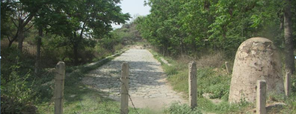
Some argue that with the shift in socio-political and religious landscape brought in by Emperor Aurangzab that the Mughal Empire began its fall. What is certain is that the following wars of succession and in fighting meant that there was a lack of a strong central power and so the maintenance of the GTR by the government also fell into decline. With the disintegration of the Mughal Empire and the lack of unifying central power the British began to come into power, beginning with the growing presence and domination of the East India Company (founded in 1600) and then total British authority over the Indian subcontinent until the mid 20th C. During this time trade was always at the forefront within the minds of the British state, bearing the interests of the EIC in mind, and although the maritime trade routes were a principal factor there was also an acknowledgement that overland trade routes such as the GTR were also vital. The GTR was realigned at some points and bridges and causeways were built using more modern techniques and materials (Chaudhari, 1978; Lawson, 1993). The modern GTR often overlies the archaeological routes and sites and so we often see the archaeological and modern infrastructure lying side by side. Such an example can be seen at Attock where the Attock Bridge and Qila Attock stand strategically over the Indus River. The incarnation of the GTR built by the British makes up much of what is still used in the modern day by the often well decorated trucks and vehicles that still carry cargo from city to city across India and Pakistan and beyond.
Sources and Extra Reading:
Bowersock, G.W. 2005. The East-West Orientation of the Mediterranean Studies and the Meaning of North and South in Antiquity. In: Harris, W. V. ed. Rethinking the Mediterranean. Oxford: Oxford University Press, pp. 168-178.
Chandra, M. 1977. Trade and Trade Routes in Ancient India. New Delhi: Abhinav Publications. pp. 78-88.
Chaudhuri, K.N. 1978. The Trading World of Asia and the English East India Company 1600-1760. Cambridge: Cambridge University Press.
Dani, A.H. 1999. The Historic City of Taxila. Lahore: Sand-e-Meel Publications.
Dar, S. R.1995. ‘Pakistan and the Silk Road: The Taxila Contexts’. In: Buddhist Route Expedition. International Seminar for UNESCO Integral Study of the Silk Roads: Roads of Dialogue. 21-30 September 1995. Kathmandu, Nepal.
Dar, S.R. 2000. Caravansarais along the Grand Trunk Road in Pakistan: A Central Asian Legacy. In: Elisseeff, V. ed. The Silk Roads: Highways of Culture and Commerce. Paris: UNESCO, 1998, pp 158-184.
Elisseef, V. 2000. Introduction. The Silk Roads: Highways of Culture and Commerce. Oxford: Berghahn.
Farishta, M.Q. 1829. History of the rise of the Mahomedan power in India till the year A.D. 1612. (Vol. 1). Translated from Persian by J. Briggs. [Online]. Available from: https://archive.org/details/HistoryOfTheRiseOfTheMahomedanPowerInIndiaVolume1 [Accessed 2 September 2017].
Frankopan, P. 2016. The Silk Roads: A New World History. London: Bloomsbury Publishing.
Kangle, R.P. 1986. The Kautiliya Arthasatra, vol. II (Book 14), 2nd ed. Delhi: Motilal Banarsidass.
Lawson, P. 1993. The East India Company: A History. London: Longman.
Levi, S. 2016. Caravans: Punjabi Khatri Merchants on the Silk Road. London: Penguin
Nath, R. 1978. History of Sultanate Architecture. Delhi: Abhinav Publications
Ojha, S. V. 2016. Uttarapath and Dakshinapath: The Great Trade Routes of Jambudwipa. Swarajya [online]. 12 August. Available from: https://swarajyamag.com/culture/uttarapath-and-dakshinapath-the-great-trade-routes-of-jambudwipa [Accessed 2 September 2017].
Rai, G.S. & Bajaj, R. 2014. The Pulsating Grand Trunk Road of Punjab: Connecting memories of civilisations. Context [Online]. 10 (2), pp. 51-60. Available from: https://search.proquest.com/docview/1544867592?accountid=14511 [Accessed 2 September 2017].
Ray, H.R. 2003. The Archaeology of Seafaring in Ancient South Asia. Cambridge: Cambridge University Press.
Skare, M. 2013. The Missing Link: From Kautilya's The Arthashastra to Modern Economics. The Journal of Philosophical Economics. 2, pp. 2-31.


Comments